
I went last night to a the opening of a small, but very interesting exhibition in the Senate House Library on the fourth floor of Senate House. As its full title ‘A Place to Call Home: Poverty and Housing in London’ recognises, it is about the history of social housing in London, beginning with the amazing maps prepared by Charles Booth, charting the patterns of wealth and poverty in London street-by-street (https://www.london.ac.uk/about/services/senate-house-library/exhibitions/place-call-home-poverty-housing-london).
The maps are available online and so are the accompanying notebooks in which the police walked round the areas recorded on Booth’s map in 1897 and 1898. One of the accompanying notebooks records a walk round Stepney on 30 December 1897. XX Place, now commemorated only by the name of our local doctor’s surgery had ’10 two storied cottages, rather rough’, while Stayner’s Road was ‘very rough, “a bad quarter, card sharpers, thieves, a few prostitutes here” (https://booth.lse.ac.uk/notebooks/police-notebooks).
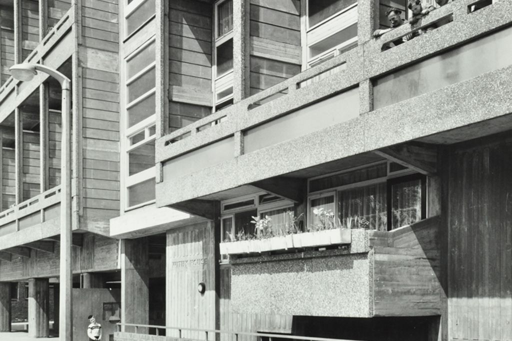
The other thing I didn’t know about and obviously should have done is the website, Layers of London, in which, again, you can explore your local neighbourhood for historical information (https://www.layersoflondon.org/). This shows a photograph of Withy House, the new social housing constructed in Stayner’s Road in 1962, described by Pevsner as a “forceful grid of balconies”:
There was an article about the exhibition in yesterday’s Guardian (https://www.theguardian.com/artanddesign/2026/oct/19/a-place-to-call-home-senate-house-london-charles-booth-maps-london-housing).

